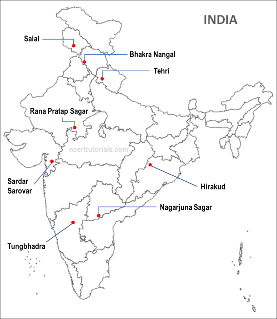
Class 10 Geography Chapter ‘Water Resources’ Map Work: The Class 10 Maps syllabus 2022-23 includes eight major dams to be located or identified on the map of India. The syllabus is given below and then the map of India will all the eight dams showing their possible precise locations.
Map Work Syllabus: Water Resources
The river and the states associated with the dams are also given here in brackets.
1. Salal (Chenab – Jammu & Kashmir)
2. Bhakra Nangal (Sutlej – Himachal Pradesh)
3. Tehri (Bhagirathi – Uttarakhand)
4. Rana Pratap Sagar (Chambal – Rajasthan)
5. Sardar Sarovar (Narmada – Gujrat)
6. Hirakud (Mahanadi – Orissa)
7. Nagarjuna Sagar (Krishna – Telangana & A.P.)
8. Tungabhadra (Tungabhadra – Karnataka)
Map Work: Water Resources (locate & label)

Click here for all maps of Class 10 Social Science


Thank you sir
very helpful thank you
Thank you so much sir
Thanks ! Sir or mam.
This map helped me in my half yearly exam.
Thank you so much sir or mam.❤️
dont worry. chill. so happy i could help
This type of map work is very useful. Especially one day before the exams. So, my warmest thank towards the creator who put this much of effort for us . Once again thanks 🙏👍
arent rivers a part?
No
thx sir