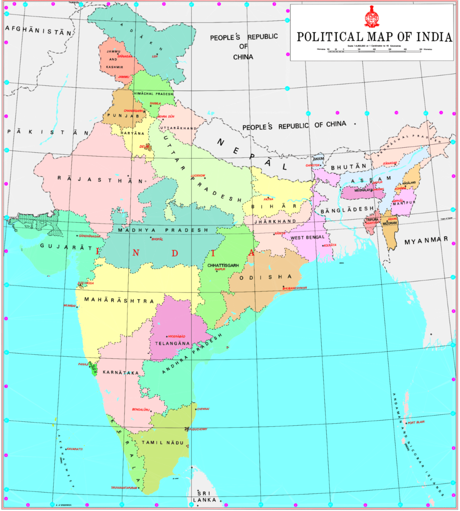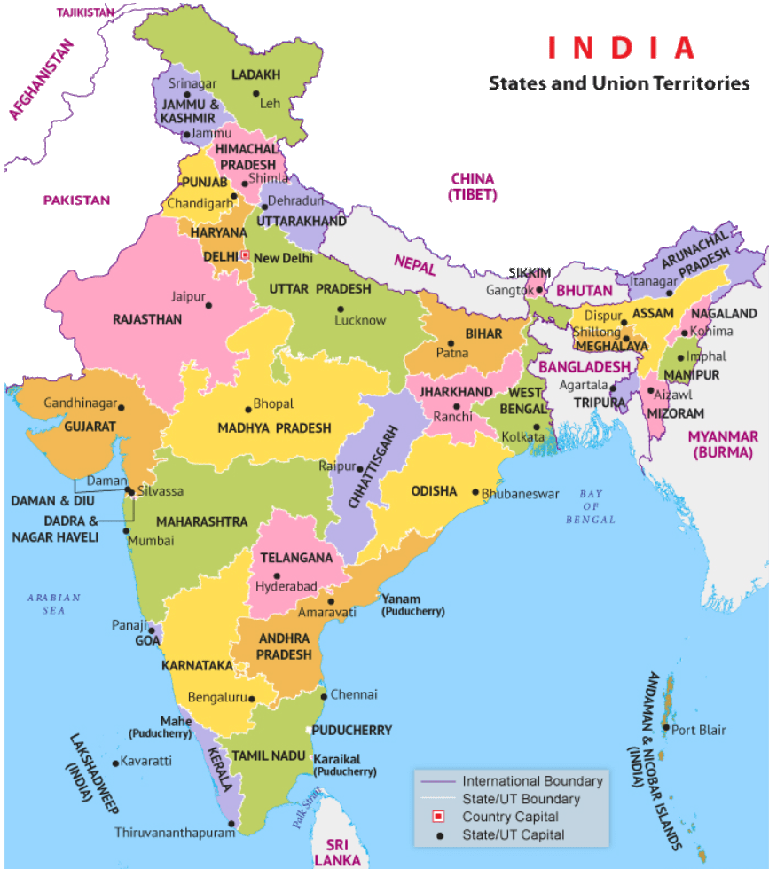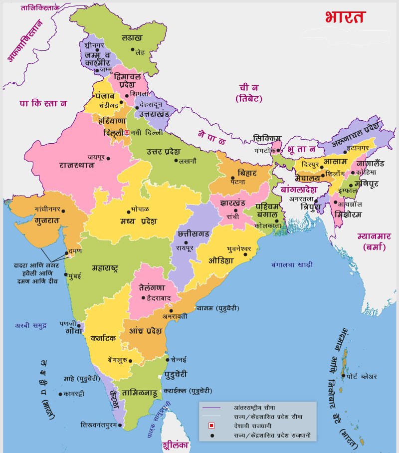

The Survey of India released the new map of India showing the Union Territories of Jammu and Kashmir and Ladakh, as these exist after 31st October, 2019. The two Union territories were carved out of the state of Jammu and Kashmir on August 5 map mentioned Hyderabad as the administrative capital of AP Andhra Pradesh.
Andhra Pradesh was separated from Telangana on June 2, 2014. Though Hyderabad was declared as the joint capital for 10 years (till June 2, 2024), bifurcated Andhra Pradesh started developing its own capital at Amaravati.
KEY HIGHLIGHTS
- The new political map of India also includes areas previously labelled as PoK.
- The two Union territories were carved out of the state of Jammu and Kashmir in accordance with the Central government’s August 5 decision.
- The two UTs came into existence on October 31, on the occasion of 144th birth anniversary of Sardar Vallabhbhai Patel, who was behind the merger of over 560 princely states into the Union of India.
- After the bifurcation of Jammu and Kashmir, the number of states in India has come down to 28 and the number of Union territories has gone up to nine.
Map Download Links: Two political maps of the country have been released by the government, linked here, and here.