

Class 10 Social Science Chapter ‘Life Lines of National has 2 Map Skills – ‘International Airports’ of India and ‘major ports’ of India. for class 10 as discussed below. See the maps and watch the videos on our channel and practise by filling blank maps of India.
Contents
show
Map-Work: Lifelines of National Economy
Major Ports: (Locating and Labelling)
a. Kandla
b. Mumbai
c. Marmagao
d. New Mangalore
e. Kochi
f. Tuticorin
g. Chennai
h. Vishakhapatnam
i. Paradip
j. Haldia

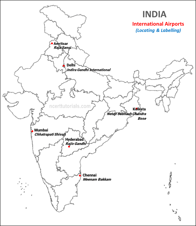
International Airports
a. Amritsar (Raja Sansi)
b. Delhi (Indira Gandhi International)
c. Mumbai (Chhatrapati Shivaji)
d. Chennai (Meenam Bakkam)
e. Kolkata (Netaji Subhash Chandra Bose)
f. Hyderabad (Rajiv Gandhi)
Okay thnx for Goa, kerela and west Bengal port names.
Thank you for the maps…. It was of great help.
Hello
It’s very helpful 🙂👍
Clear representation of maps thank u
Thank you
Thank you so much.
bhagwaan aapka bhala kare
map thank you me no englid=sh me cbse nice no
jai shree ram
thnx..
Thankx…
I am learning it just 15 minutes before board exam
THANK YOU FOR THE MAPS
IT HELP ME
THANK YOU SOO MUCH!!!CAME USEFUL IN PREBOARDS
thx
Thank You bhai!
you missed one int airport gujrat — sardar patel international airport